Comprehensive Topographic Surveys in West Columbia
Detailed Site Mapping for Successful Development Projects
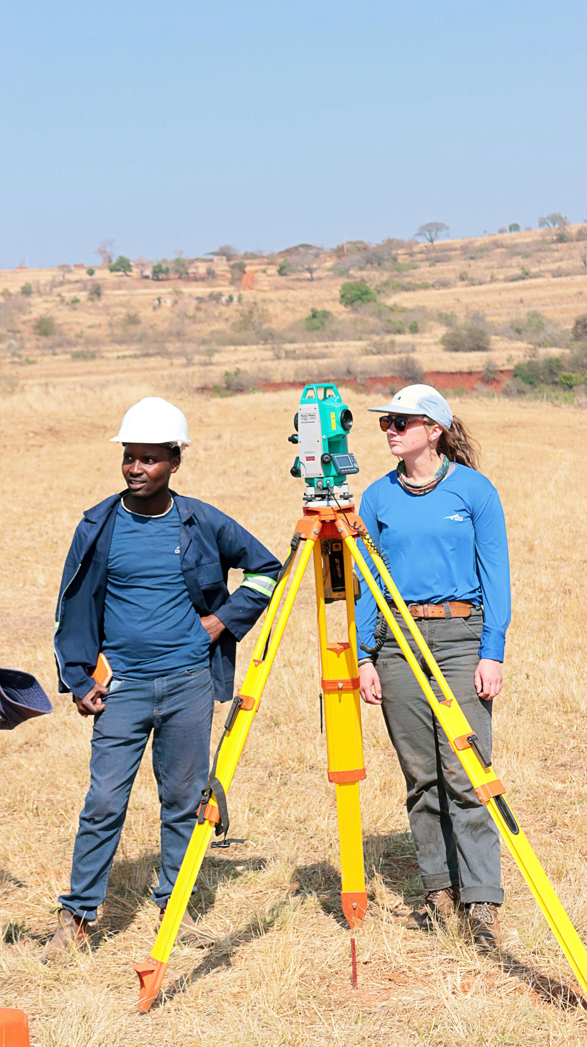
Accurate elevation data and site feature mapping form the foundation of successful construction and development projects throughout West Columbia. Our detailed Topographic Surveys capture ground contours, elevations, and existing site features essential for engineering design, grading plans, and environmental compliance.
We integrate survey data using advanced CAD and GIS software for seamless coordination with architects and engineers.
Our comprehensive mapping reflects the region's varied terrain, from the rolling hills near the Congaree River to the flatter areas extending toward Lexington, ensuring accurate site preparation for any development type.
Get in touch at (803) 791-8467 today to arrange detailed topographic mapping of your West Columbia property.
What's Included in Our Topographic Survey Services?
Our topographic mapping process captures precise elevation data, natural features, and man-made improvements to create comprehensive site documentation. We map contour lines, spot elevations, trees, structures, utilities, and drainage patterns to provide complete site intelligence for design and engineering work.
Field data collection uses advanced GPS and electronic distance measurement tools to ensure sub-inch accuracy across your entire site. Midlands Surveying processes this information through sophisticated CAD systems, delivering professional drawings that integrate seamlessly with architectural and engineering workflows.
Our surveys are commonly performed for new construction projects across Columbia, Irmo, and Chapin, supporting everything from single-family homes to major commercial developments with detailed site intelligence.
Schedule your comprehensive topographic mapping by calling (803) 791-8467 today.
West Columbia Topographic Survey Advantages
Our local knowledge and advanced mapping capabilities ensure topographic surveys that support successful project outcomes from initial design through final construction.
- Why choose local surveyors? Our experience with West Columbia's diverse terrain helps us capture the subtle elevation changes and drainage patterns critical for proper site design and stormwater management
- How do we ensure comprehensive data? We map all significant site features including vegetation, utilities, structures, and natural drainage to provide complete design intelligence
- What makes our deliverables valuable? Detailed CAD drawings support permitting requirements and provide the precise elevation data essential for grading and drainage planning
- How do we support project efficiency? Our digital integration capabilities allow architects and engineers to import survey data directly into their design software, reducing errors and accelerating project timelines
- How do we serve West Columbia specifically? Our familiarity with local soil conditions, drainage patterns, and development regulations helps ensure surveys meet both technical and regulatory requirements
Ensure your development project starts with accurate site intelligence and professional topographic documentation. Contact us at (803) 791-8467 to schedule your Topographic Survey in West Columbia.